Apr 29, 2022
GPS is Not Good Enough for Mapping Sustainable Supply Chains

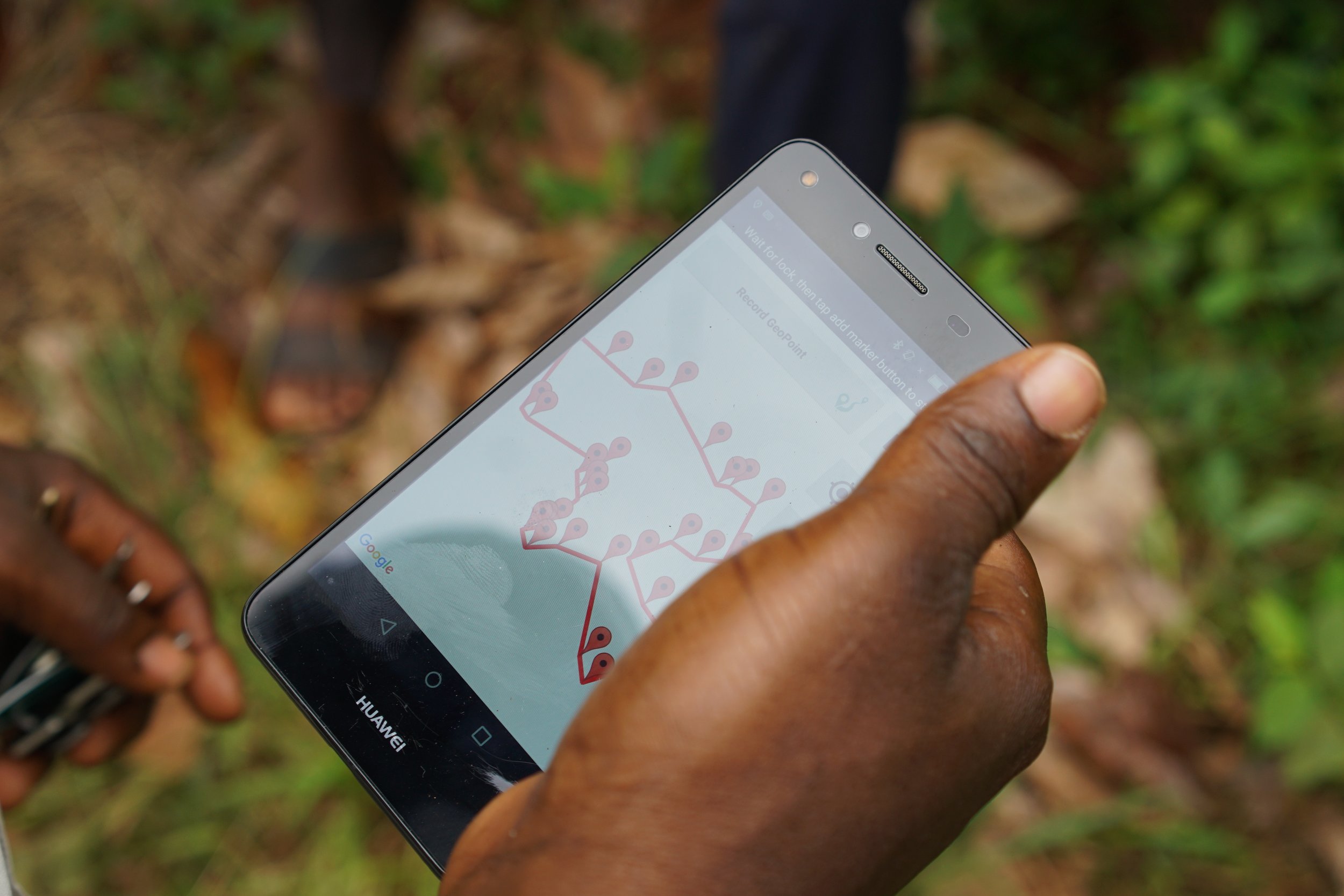
Sourcemap’s software allows for polygon mapping even in remote, rural areas
Op-Ed by Marissa Ruby Brock, Director of Policy, Sourcemap
The most ambitious sustainability regulations across the EU have converged on the need for supply chain mapping to ensure that suppliers comply with environmental and social standards. An important step forward, supply chain mapping requires importers to identify the names and addresses of all of their suppliers, from finished goods down to raw materials. But for many commodities, we can do better. That is why we support Mars' call for polygon boundary mapping of the farms where high-risk commodities are grown. It's the standard we have used for best-in-class supply chain traceability since 2017, when the worldwide proliferation of cheap smartphones made polygon mapping no more difficult than simple GPS point-mapping.
Farm-level polygon boundary mapping is being debated as part of the new EU anti-deforestation legislation, and it risks being watered down to only require the far less effective and outdated practice of GPS point mapping. GPS point mapping for high-risk agricultural commodities is a relic from a bygone era. Here’s why it’s not enough: Even if you have mapped all of your suppliers down to the farm level, GPS point mapping can only show you the approximate location of a farm, not any information about its shape or size. GPS point mapping is not just outdated from a technology perspective; with changing legislation around forced labor and environmental risks it is no longer sufficient to meet the burden of proof for a “clean” supply chain.
Polygon mapping provides a number of advantages, including the ability to monitor farms with satellites to ensure that they are not encroaching on sensitive ecosystems. Polygon mapping also enables far more, from ensuring that the appropriate amount of fertilizer and pesticides are used, to guaranteeing that farmers and their families are being paid fairly for the crops they grow. And, as our CEO testified before the US Senate in 2021, it's a foundational step to ensuring that crops are being grown without resorting to forced or child labor.
Since we made the switch to polygon mapping five years ago, Sourcemap has enabled the polygon mapping of the majority of certified cocoa and palm oil in the world, as well as a significant amount of other commodities including coffee, soy, beef and rubber. It's been proven to work in the most remote parts of the world, including communities with limited or no internet access.
By including the requirement for polygon mapping, the EU will level the playing field for all companies seeking access to the common market. It's the right thing to do for farmers, for the environment, and for EU businesses and consumers.


